The Seed A Legacy program makes it easy for owners and managers of private, public & corporate lands to create pollinator habitat that makes a difference.The program helps to establish high-quality pollinator habitat projects following our NextGen habitat project designs and NextGen seed mixes. We provide free seed and one-on-one technical guidance to ensure the success of every project. Our NextGen habitat projects are customized to your location and consist of two separate plantings: half of the site is planted with a NextGen Honeybee Seed Mix that includes many clover species, while the other half of the site is planted with a Monarch Butterfly Seed Mix that includes many native wildflowers.
Our Seed A Legacy pollinator habitat projects have been documented to provide increased pollinator benefits over other pollinator conservation programs.*
|
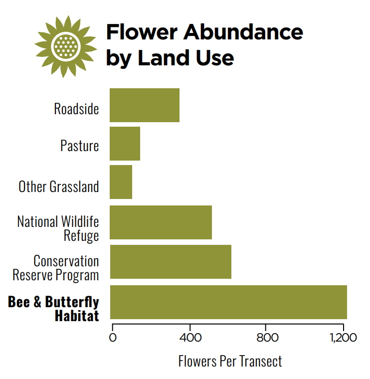
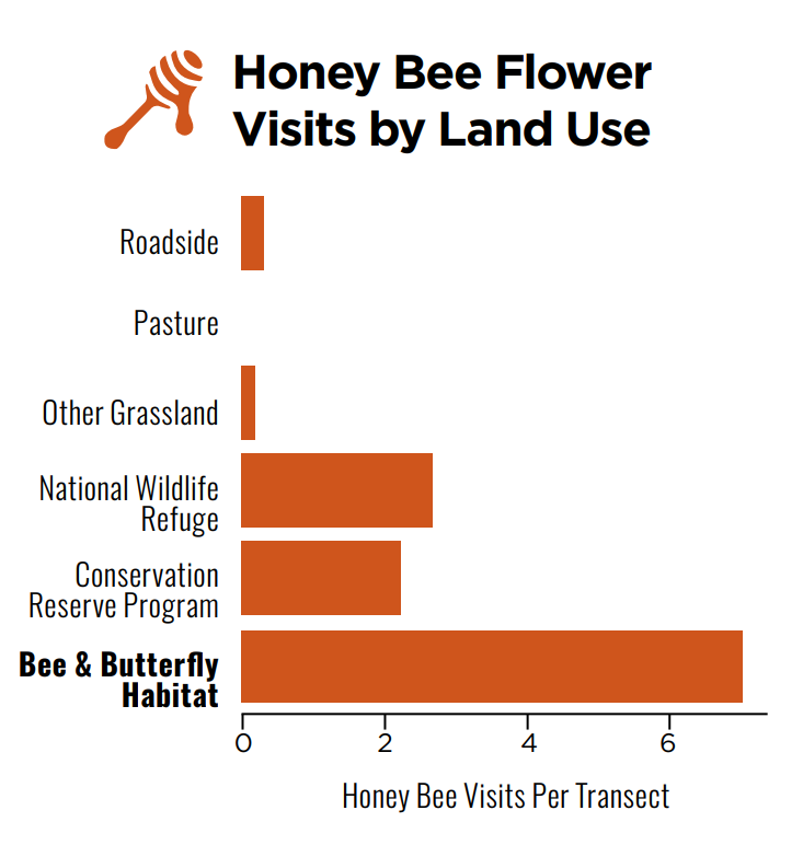
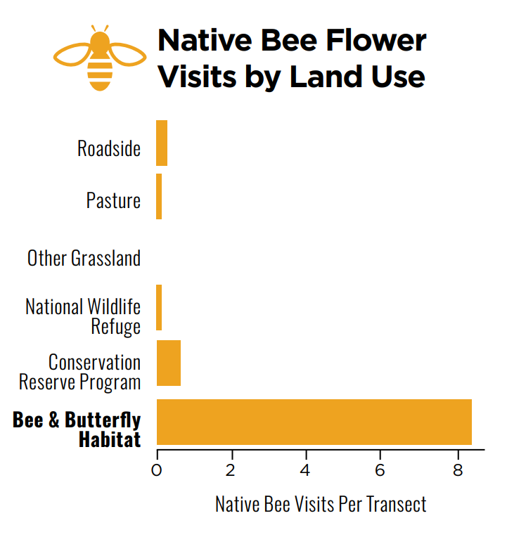
*Results from this study.
|
How Does it Work?
We identify private, public and corporate projects with the highest potential to create pollinator habitat, then design a NextGen seed mixture to maximize pollinator support. Each project receives FREE* seed and one-on-one technical guidance to maintain the project over the next 5 years. *Up to 25 acres. Projects larger than 25 acres receive seed mixture at heavily discounted rates. |
Who Qualifies?
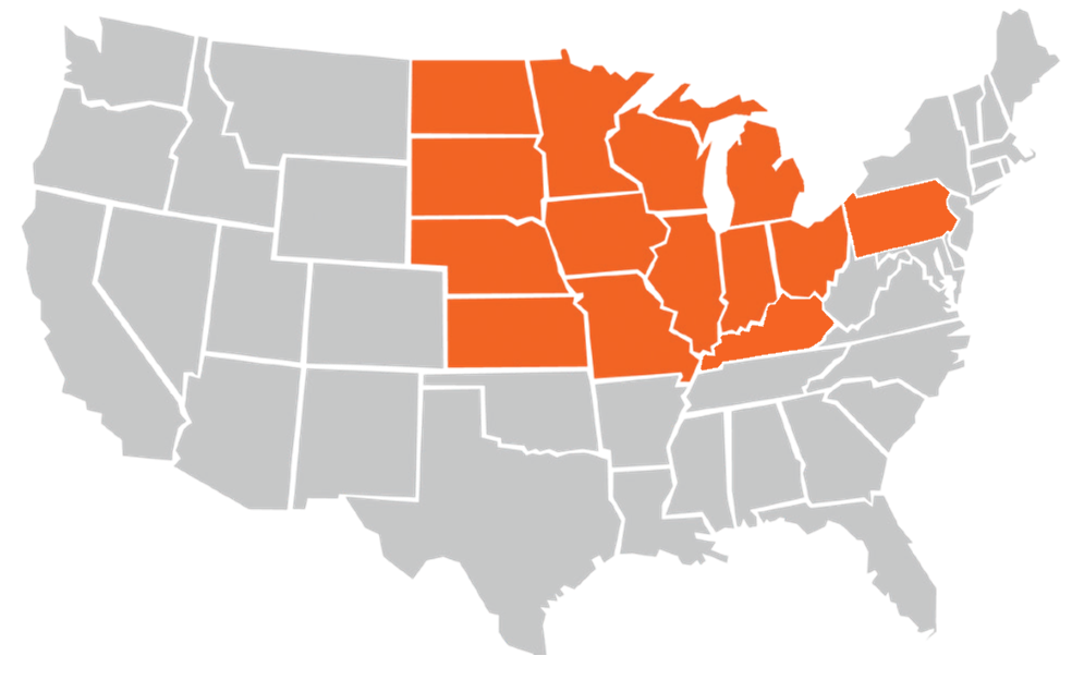
We currently work with landowners & land managers that have 2+ acres AND are located in the 14-state region shown above. *More states will be added soon! Why these states? The Midwest is a critical area for all pollinators, encompassing both the migration route of the monarch butterfly and critical honey bee habitat. |
The numbers
Since 2017, the Seed A Legacy program has planted...
4,955acres of pollinator habitat
|
16.7 Millionmilkweed seeds
|
7.5 Billiontotal seeds
|
What if I'm not in the 14-state region?
What can I do to help pollinators?
Plant pollinator-friendly flowers in your yard. Check out our Habitat Guide.
Fill out the Interest Form to be notified when we expand into your state.
Donate: Every dollar raised means more pollinator habitat created.
Help promote our efforts: Follow us on Facebook, Instagram, and LinkedIn.